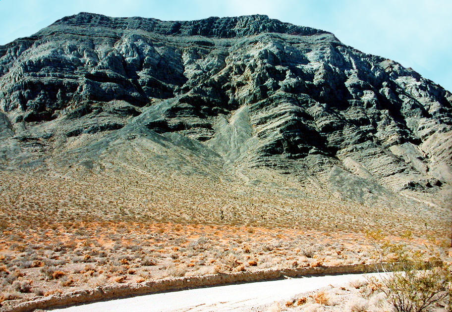
| Near the type locality (where a geologic formation was first described in the scientific literature) of the Middle to Upper Devonian Lost Burro Formation at the southern end of Lost Burro Gap in Death Valley National Park, California. The view here is west from the junction of Hunter Mountain Road and the primitive jeep track that takes off to Rest Spring Gulch. Roughly the lower one-third of the mountainside is composed of the Lower Silurian to Lower Devonian Hidden Valley Dolomite (which contains locally abundant corals and brachiopods); a little more than a third of the middle portion of the mountain is the Middle to Upper Devonian Lost Burro Formation--a stromatoporoid sponge-rich sequence of dolomites, limestones, sandstones, quartzites and shales that bears common brachiopods, crinoid debris, bryozoans, and an occasional gastropod (famous Orecopia, as a matter of fact). Darker "sliver" of strata to skyline, above the lighter band of Lost Burro Formation, consist of dark blue limestones and shales belonging to the Lower Mississippian Tin Mountain limestone--an incredibly fossiliferous Paleozoic Era unit that contains an amazing diversity of solitary and colonial corals, gastropods, trilobites, ostracods, brachiopods, crinoids, bryozoans, and goniatites ammonoids. The photograph, by the way, was originally snapped with a Nikon 35mm camera. |